HIGHLIGHTS
- Thammasat University, NSTDA, and AIT are jointly protecting a 2,753-rai area by integrating a flood defence infrastructure of walls and earthen embankments totalling 10,157.75 metres in length.
- Water is systematically managed using three main pumping stations, alongside the utilisation of a 131-rai internal canal area acting as a retention basin to slow down and drain water.
- Operational readiness is elevated through the establishment of a Command Centre and 14 specialised operational units to handle emergencies and repair vulnerable points immediately.
- Real-time risk monitoring is conducted via a three-colour warning flag system based on the Chao Phraya River water level data, ensuring a safe environment in line with the Good Campus strategic goal.
September 2026 brought difficulties from heavy rainfall and the threat of flooding in the Bangkok Metropolitan Region. Thammasat University, Rangsit Centre, led by the Physical Development, Utilities and Environment Office under the Rangsit Centre Administration Division, tackled this situation with a flood prevention system designed from past lessons. This was combined with a proactive operational plan in collaboration with network institutions to maintain a safe environment (Good Campus) and safeguard the quality of life for students and staff (Good Life) in accordance with the organisation’s sustainable development policies.
Infrastructure Designed from Empirical Data
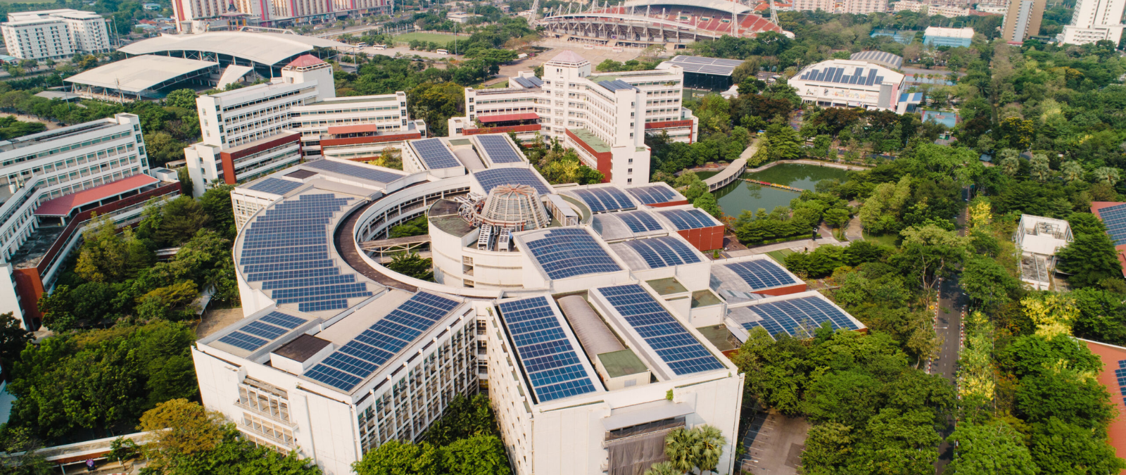
Thammasat University, Rangsit Centre, is situated on state property totalling 2,753 rai, 2 ngan, and 06 square wah. This area is divided into leased spaces for the Asian Institute of Technology (AIT) covering 832 rai, 2 ngan, and 62 square wah, and the National Science and Technology Development Agency (NSTDA) covering 195 rai, 1 ngan, and 36 square wah. Therefore, flood prevention requires infrastructure that encompasses all three institutions.

Based on data from the 2011 flood crisis, where the water level reached 4.70 metres above mean sea level (MSL), the university has completely redeveloped its physical defence system. An external flood protection wall was constructed with a total length of 10,157.75 metres, divided into:
- A concrete wall with a height of 5.20 metres (MSL) from the Main Stadium gate to NSTDA and AIT.
- An earthen embankment with a height of 4.70 metres (MSL) along Phahonyothin Road, Chiang Rak Road, and the AIT area.
In addition to the external flood walls, the university utilises its entire internal canal area of 131 rai (209,600.50 square metres) to receive water, working in tandem with three main pumping stations: the Phahonyothin Pumping Station, the Main Stadium Pumping Station, and the Asian Games Dormitory Pumping Station. Each station is equipped with three water pumps, with a drainage capacity of 2 cubic metres per second per pump.
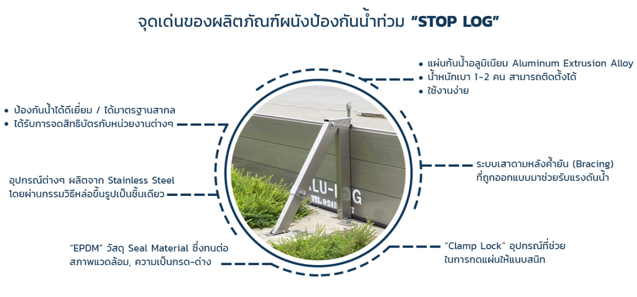
At the entrance and exit gates, the university has implemented aluminium floodgate technology (ALU-LOG Stop Log). This equipment is designed for rapid assembly and dismantling. Each barrier panel features EPDM rubber to prevent water seepage and comes with a maintenance manual stipulating equipment inspection and cleaning every four months.
Command Process and 14 Operational Units
Physical infrastructure operates at full efficiency when paired with a clear management system. Thammasat University, together with NSTDA and AIT, has developed a flood prevention drill manual for the year 2026, simulating a crisis scenario where the water level continuously rises from the north.
The primary response mechanism is the establishment of a Command Centre (War Room) responsible for assessing the situation, issuing orders, and monitoring outcomes. This centre is headed by key executives such as Assoc. Prof. Dr. Theera Jiasiripongkul (Vice Rector for Administration, Rangsit Centre), Assoc. Prof. Dr. Paruhas Tor-Udom (Vice Rector for Administration, Health Science Centre), Assoc. Prof. Dr. Surapap Kaewsawatwong (Assistant to the Rector for Administration, Rangsit Centre and Health Science Centre), Asst. Prof. Dr. Supakit Pruksaaroon (Assistant to the Rector for Administration, Rangsit Centre and Health Science Centre), and Miss Mayulee Sudsara (Director of the Rangsit Centre Administration Division).
The university has divided its operational teams into 14 units under the War Room to systematically distribute responsibilities. Key units include:
- Embankment and Dam Strength Inspection Unit: Inspects for water seepage, cracks, and vulnerable points.
- Rapid Response Unit: Deploys to the area to fix leaks and reinforce earthen embankments immediately upon receiving a report.
- Flood Drainage Unit: Responsible for overall water management, both exterior and interior of buildings.
- Utility Repair Unit: Assesses the situation to consider shutting down vital mechanical and electrical systems, preventing damage to high-value assets.
Real-Time Risk Monitoring and Warning System Based on Actual Data
To reduce communication confusion, the university has established a flood prevention plan through warning levels indicated by the colour of the flag at the Phahonyothin Pumping Station, referencing the Chao Phraya River water level data from the Suan Thep Pathum measuring station (Old Provincial Hall, Pathum Thani Province) as follows:
- Green Flag (Normal State – Surveillance): Water level at 2.50 metres (MSL).
- Yellow Flag (Warning State – Prevention): Water level at 3.00 metres (MSL).
- Red Flag (Evacuation Risk State – Crisis): Water level at 3.50 metres (MSL).
The integrated preparedness across databases, engineering infrastructure, and personnel operational plans enables the flood prevention system of Thammasat University, Rangsit Centre, to create a positive impact (Good Impact). This goes beyond merely protecting the internal campus area, as it also promotes infrastructure security in collaboration with the neighbouring research agencies and international educational institutions.
*Remark on Thai land measurement units used in this article:
Rai: The principal unit of land measure in Thailand. 1 rai = 1,600 square metres (approx. 0.395 acres or 0.16 hectares).
Ngan: 1 ngan = 400 square metres (one-quarter of a rai).
Square Wah (Sq. Wah): 1 square wah = 4 square metres.